.png)

_logo%201.svg)


AI Summary
Machine learning engineers working with geospatial data face a peculiar contradiction. One frontier AI model can write sophisticated Python code using GDAL libraries and perform complex spatial queries, while another struggles to correctly name states on a map. This dichotomy reveals a fundamental challenge in the geospatial AI landscape: the gap between promise and production reality.
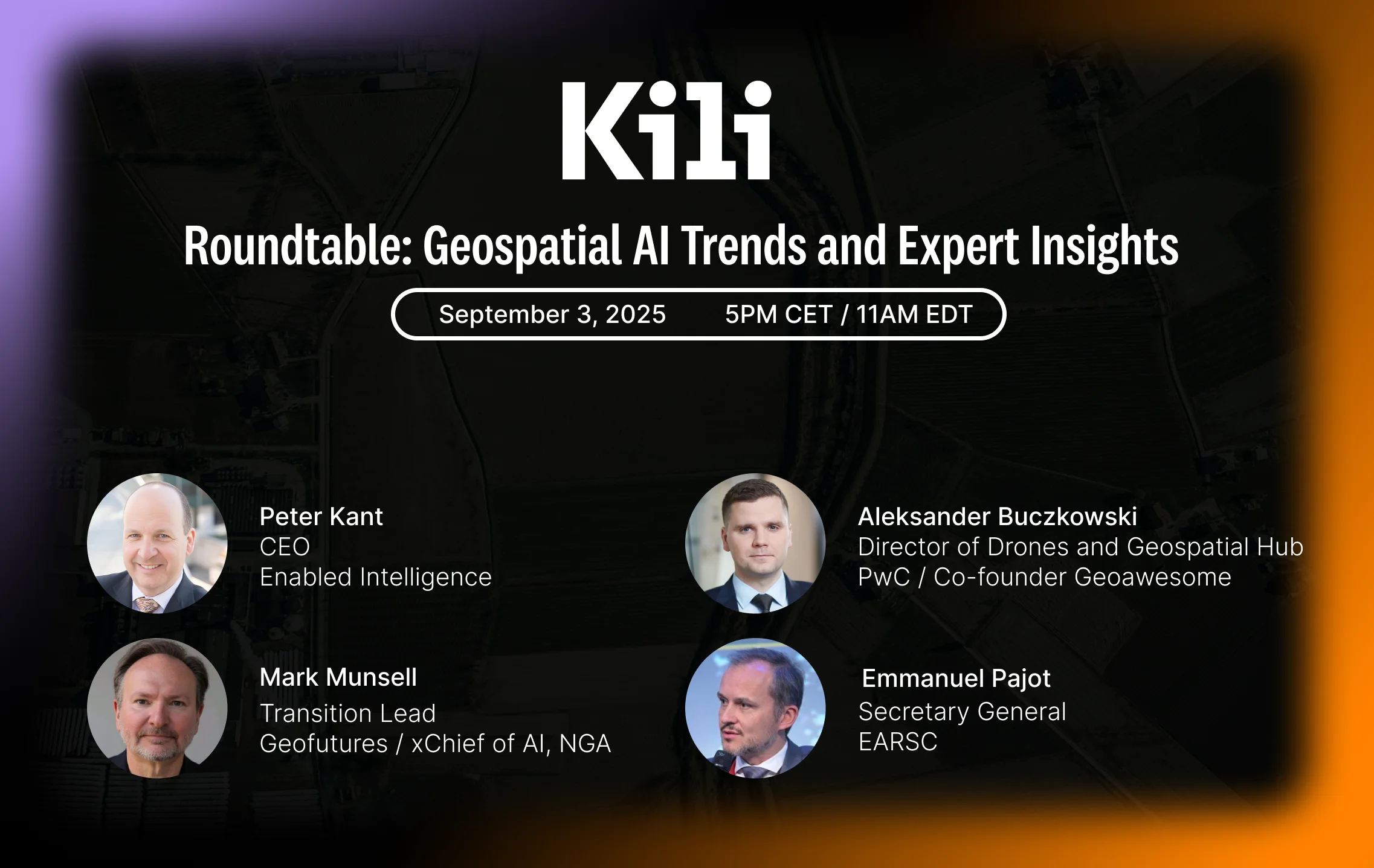
We recently hosted a roundtable discussion with leading experts from government, consulting, and technology sectors to examine the current state of geospatial AI implementation. The conversation revealed that while geospatial AI has moved beyond proof-of-concept in specific domains, the path to production-ready solutions remains more complex than many organizations anticipate.
Production Reality: What's Actually Working at Scale
The most successful geospatial AI implementations today combine traditional approaches with modern AI capabilities rather than replacing them entirely. Mark Munsell, former Chief AI Officer at the National Geospatial Intelligence Agency, shared insights from the evolution of the MAVEN program—a foundational effort that began in 2017 and demonstrated the complexity of real-world geospatial applications.
"The sales pitch was, hey, Silicon Valley can do this with street cameras, so why don't we just apply it to drones for defense?" Munsell explained during our discussion. "As it turned out, that was very difficult to do. It wasn't a direct correlation in application."
The program's eventual success came through building comprehensive platforms, generating massive labeled datasets, and iterating through failures.
Today, Munsell estimates that the most effective implementations combine retrieval-augmented generation (RAG) with agentic AI to automate approximately 80% of traditional geospatial workflows.
Meanwhile, Alexander Buczkowski, Director at PwC's Global Center of Excellence for drone and geospatial technologies, observes similar patterns in commercial applications. "When you think about problems such as deforestation or detecting building footprints, those models actually work," he noted.
However, he also highlighted a critical challenge: "Our clients are a little bit spoiled by the promise of those models. They would wish to get a ready working tool that will serve them the answers they are looking for."
The complexity increases significantly with more advanced requirements. While detecting building footprints proves relatively straightforward, determining whether structures are under construction or completed remains challenging for current models—illustrating the precision limitations that organizations must navigate.
Which industries and use cases have worked?
Peter Kant, CEO of Enabled Intelligence, provided concrete examples of production deployments in infrastructure monitoring and defense applications. His company processes geospatial data ranging from regular electro-optical imagery to synthetic aperture radar, hyperspectral, and radio frequency data.
Buczkowski confirmed that simpler use cases like deforestation monitoring and building footprint detection are working reliably in production environments. However, he noted that more complex applications—such as determining construction status or detailed feature classification—still require significant development.
Munsell highlighted agriculture as a particularly promising sector, noting that "the same techniques you use for infrared band to detect a human hiding in the woods are the same techniques you would use to detect unhealthy crops." He also identified transportation, logistics, advanced manufacturing, and human health applications as areas showing strong potential for geospatial AI integration.
The success in these domains stems from clear requirements and measurable outcomes rather than exploratory AI implementation.
The Partnership Advantage: Why 95% of AI Pilots Fail
Recent MIT research revealed a stark statistic: 95% of AI pilots fail to reach production, while partnerships succeed 67% of the time compared to 33% for in-house builds. This disparity reflects a fundamental challenge many organizations face when implementing geospatial AI.
Kant described this challenge as the "blinking cursor problem" during our roundtable. Organizations open an AI interface and find themselves uncertain how to proceed. "They have their own languages, their own jargon, their own data types. They understand how their data works, but how that applies in an AI tool, they don't."
Furthermore, Buczkowski emphasized that pilot project failures often stem from structural issues rather than technological limitations: "Companies are doing it wrongly because they are doing it in an isolated way, having very limited teams being involved, not understanding and not focusing on the business outcome and the integration of solutions into full processes."
The most successful implementations emerge when domain expertise meets AI capability. Organizations that understand agricultural yields, water usage, or infrastructure analysis must partner with teams that know how to apply this knowledge to specific AI models and use cases.
The European Perspective on Collaboration
Emmanuel Pajot, Secretary General of the European Association of Remote Sensing Companies (EARSC), added valuable context about industry collaboration patterns. He noted that 96% of earth observation companies are SMEs, creating inherent challenges for developing internal AI capabilities. This statistic suggests significant opportunities for partnership-based approaches in the European market and potentially other regions with similar industry structures.
"We can see that there are some companies that have the capability because of their size to really have a dedicated team," Pajot observed. "But for most of them, they are searching for opportunities to partner with maybe a non-EO company to integrate, capitalize, and develop."
The Skills Evolution and Human-AI Collaboration
The geospatial industry faces a paradox: while AI promises to automate many tasks, finding skilled professionals has become increasingly difficult. Pajot identified access to skilled professionals as the second-largest barrier to growth for earth observation companies.
"For a lot of engineers or computer scientists or AI guys, space is not seen today as a path for their career," Pajot explained. "We need to showcase the value of space. Space is not only rocket science; it delivers knowledge and benefits for citizens."
This shortage creates particular challenges as the industry transitions. Munsell warned of parallels with software engineering, where senior engineers remain viable while junior positions face layoffs due to AI automation. "You still have to know software, databases, and geo. You still have to know all three of those things to build useful products and services."
Innovative Workforce Approaches
Kant shared insights from Enabled Intelligence's innovative approach to workforce development, where over 50% of their workforce consists of neurodiverse individuals, particularly those on the autism spectrum. This approach yields 95% accuracy rates in data labeling, which translates to higher-performing AI models that require less computational resources.
"By having a spectrum of people and thought processes contributing to the data that is training the AI, you are actually creating AI tools that can think more comprehensively," Kant explained.
Multimodal Integration: The Next Frontier
Beyond workflow automation, the most promising developments involve combining multiple sensor types and data sources. Kant described significant progress in applications that merge radio frequency information with electro-optical data, or synthetic aperture radar with ground-based elements.
"The ubiquity of multiple types of sensors in low Earth orbit allows us to take advantage of their benefits and cover their individual limitations," he noted. These multimodal approaches have proven effective in weather analysis, agricultural monitoring, mining applications, and logistics.
However, this sophistication introduces new complexities. Understanding data provenance, timing, and source characteristics becomes crucial when working across multiple sensor types and AI models—challenges that require both technical expertise and robust data management platforms.
Looking Toward Foundation Models
The development of geospatial foundation models represents both significant promise and notable challenges. Current implementations reveal fundamental inconsistencies that organizations must navigate when evaluating these technologies.
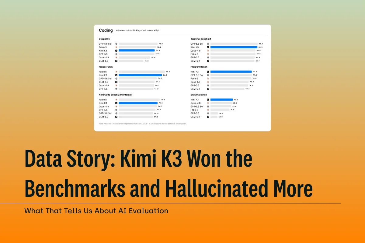
Munsell described testing frontier models with mixed results: "One of the frontier models, I asked it to do a certain type of spatial query, get the results back and sort of do a join and things like that. And it knew to go off, it knew the Python library, it knew the GDAL, it knew the type of Python to write for ST geometry." Yet he also noted the inconsistency: "then another new model came out and brilliant model, and it can't name maps correctly. It doesn't even know like to name the states correctly."
This dichotomy highlights a fundamental challenge with foundation models in geospatial applications. While they may excel at code generation and technical implementation, their spatial reasoning and geographic knowledge can be unreliable. Munsell emphasized that "there's such a dichotomy of capability in the GIS world. It will only be solved if there's a good business case to do it."
However, Buczkowski anticipates rapid acceleration in capabilities: "I do strongly believe that while those challenges are indeed happening, when you look backwards, where chatGPT was two years ago, and where it is right now, I think that this revolution to GeoAI might come actually much sooner than we all rationally think about this." His perspective suggests that the current limitations may be temporary as AI development continues at an unprecedented pace.
The current market dynamics reflect this challenge. Munsell observed that while "the business case for big foundation models, geo foundation models is still evolving," major technology companies are primarily demonstrating capabilities rather than delivering production-ready solutions. "Google's showing off, right? With what they're doing there. It will eventually turn into these business cases where it'll be very, very useful as well."
The business case challenge reflects broader market dynamics. Foundation models prioritize domains with large commercial potential—law, medicine, accounting—while geospatial applications receive less focused development attention.
This reality suggests that specialized geospatial models or carefully tuned implementations of general models will likely be necessary for reliable production use.
Data Trust and Quality: The Foundation Challenge
Unlike the rapid adoption seen with large language models, geospatial AI follows a more measured adoption curve. Buczkowski observed, "I don't see the same level of enthusiasm as with LLMs because Geo AI still has things to prove to clients and users. But certainly the hype around AI in general makes decision makers more aware that you could leverage AI in that space."
This trust challenge manifests across multiple dimensions. Kant emphasized the critical importance of data provenance in multimodal applications: "knowing your data provenance, knowing where it's coming from, when it was taken, when it was sourced" becomes essential when combining multiple sensor types and AI models. Organizations must understand not just what their AI systems can do, but precisely how and why they reach specific conclusions.
The trust deficit also extends to model behavior and limitations. Munsell highlighted the unpredictable nature of current AI capabilities: one frontier model can handle complex geospatial queries while another fails at basic geographic tasks. This inconsistency makes organizations cautious about broad deployment without extensive validation.
Pajot emphasized that building trust requires active engagement with end users: "We need to really focus on the trust in these solutions. The developed technological capabilities is a thing, but to create a market and develop it, you need to have the trust of the users, the customer." He noted that this involves not just technical validation but also addressing concerns about AI ownership, sovereignty, and control—particularly relevant for European organizations evaluating AI solutions.
This measured approach may actually benefit long-term adoption. Rather than experiencing the ChatGPT moment that led to widespread experimentation followed by disappointment when limitations became apparent, geospatial AI implementation focuses on concrete use cases, measurable outcomes, and systematic trust-building with stakeholders.
Strategic Implications for 2026
Our panel experts offered varying predictions for developments over the next two years, although a consensus emerged around infrastructure improvements and specialized applications, rather than universal consumer tools.
Munsell predicted that increasing computational infrastructure will enable "a killer app, a global unicorn thing" built on the convergence of ubiquitous satellite constellations, advanced processing capabilities, and sophisticated AI models. However, he also emphasized that current business cases favor RAG and agentic implementations over large foundation models.
Buczkowski anticipated a fundamental shift in human-data interaction: "I do hope that there will be a major shift coming to how we interact with Earth observation data. So being able to have large language models to ask specific questions, to extract information from Earth observation data." He envisions a future where users focus on asking the right questions while AI handles data selection and analysis automatically.
Conversely, Kant offered a unique perspective on space-based applications: "I think the first killer app will not be something that looks down necessarily, but something that's looking sideways or up and down to help coordinate" satellite operations and avoid catastrophes, highlighting the growing complexity of space traffic management.
Pajot focused on organizational maturity: "It will be a year where companies will better understand where they should invest to optimize, maybe not new solutions, but optimize their current ones to develop internal trust."
Implementation Recommendations: Our Key Insights
Based on the expert insights from our roundtable and our experience supporting geospatial AI implementations, we offer these strategic recommendations:
Start with clear business cases and measurable outcomes. Our panelists consistently emphasized that successful implementations focus on specific problems rather than exploring AI capabilities generally. We recommend defining integration requirements and success metrics before selecting tools or partners.
Plan for strategic partnerships over in-house development. The 67% success rate for partnership approaches reflects the complexity of combining domain knowledge with AI expertise. Few organizations possess both capabilities internally, and the data suggests that acknowledging this reality early improves outcomes significantly.
Invest in human expertise alongside automation. While AI automates routine tasks, understanding geospatial principles, data limitations, and quality requirements remains essential. We've observed that the most successful deployments maintain strong human oversight and domain expertise.
Expect iteration and learning cycles. The most successful programs, including MAVEN, evolved through multiple failures and refinements. We recommend budgeting for learning cycles and pilot iterations rather than expecting immediate production deployment.
Focus on data quality and annotation precision. Our discussions revealed that higher-quality training data creates more efficient models that require less computational resources—a finding that directly impacts both performance and operational costs.
The geospatial AI landscape in 2025 reflects an industry moving beyond initial hype toward practical implementation. While foundation models and automated workflows show genuine promise, success requires understanding both technological capabilities and limitations. Organizations that approach implementation strategically, with appropriate partnerships and realistic expectations, position themselves to capture the substantial benefits available from mature geospatial AI applications.
Effective GeoAI starts with High-Quality Data
Did our expert discussion resonate with you? Are you looking to implement GeoAI that succeeds from pilot to production? It all starts with high-quality data. Talk to our team about your use case to find the best solutions for building geospatial datasets.
![Best On-Premise Data Labeling Platforms for Regulated Industries [2026] Guide](https://cdn.prod.website-files.com/68da32b2041c593b0511a582/6a574849a90d08dc8b9b547d_Competitor%20Article%20-%20Listicle%201%20(2).webp)