.png)
AI's Growing Impact on Modern Agriculture
The agricultural sector faces unprecedented challenges in the 21st century. A growing global population demands increased food production while climate change and resource scarcity place immense pressure on traditional farming practices. To navigate these complexities, the industry increasingly looks toward transformative technologies like artificial intelligence and satellite imagery.
This blog post is based on our recent presentation at the Geospatial World Forum 2025 in Madrid, Spain this month, where we explored the intersection of AI, collaborative workflows, and agricultural data quality.
The AI in Agriculture Market is projected to experience substantial growth, increasing from USD $1.7 billion in 2023 to USD $4.7 billion by 2028, reflecting a strong belief in its capacity to revolutionize farming. AI offers solutions ranging from optimizing resource use and predicting pest outbreaks to enhancing crop yields and automating farming tasks.
Similarly, satellite imagery provides a powerful tool for monitoring vast agricultural landscapes, offering timely data on crop health, soil conditions, and other critical environmental factors. The convergence of these two advanced technologies holds the promise of a new era in agriculture, characterized by data-driven decision-making and precision farming techniques.
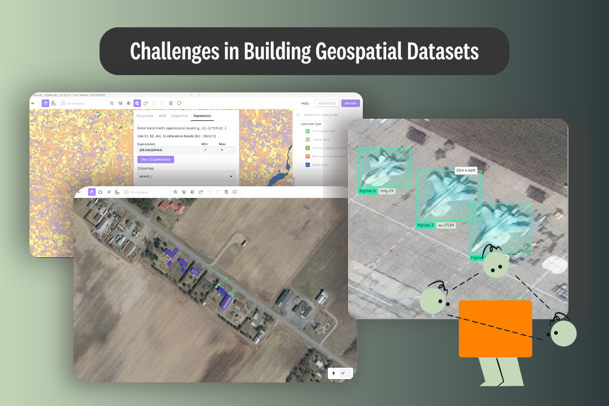
The Hidden Costs of Agricultural Data Pipelines
Despite the promising potential, implementing AI in agriculture comes with significant challenges. Reports indicate high failure rates across industries, with recent data suggesting 47% of AI projects do not reach the production stage. Furthermore, 87% of analytics leaders report that poor data quality led to project failures or cancellations.
The disconnect between raw satellite data and actionable agricultural insights significantly impacts farm productivity and sustainability, leading to several critical issues:
- Missed Intervention Windows: When data processing is delayed or inaccurate, farmers miss crucial timeframes for addressing crop issues.
- Environmental Monitoring Gaps: Inconsistent data collection leads to blind spots in environmental monitoring.
- Inaccurate Risk Assessment: Poor data quality results in flawed risk evaluations for agricultural operations.
- Resource Misallocation: Without reliable insights, resources like water, fertilizer, and labor are inefficiently distributed.
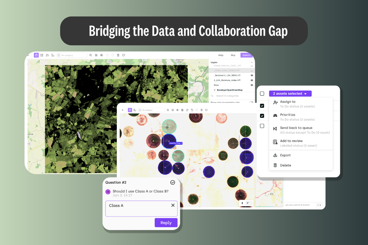
The Collaboration Gap in Agricultural Geo Observation
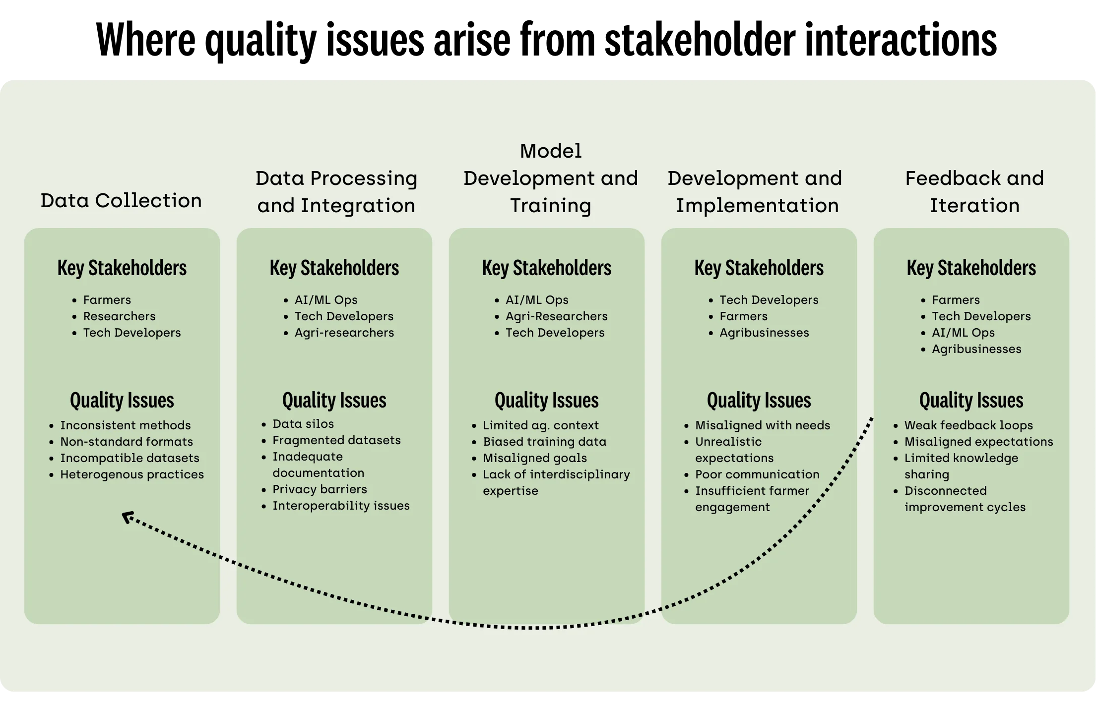
Agricultural AI faces unique challenges that standard geospatial tools aren't designed to address. Research identifies three key collaboration barriers affecting agricultural AI implementation:
Stakeholder Silos
Limited collaboration between business, operations, and technical teams affects alignment and impact. Insufficient communication between the business side of agricultural operations and the technical teams developing AI solutions creates disconnects in understanding and implementation.
Expertise Gap
Weak integration between data teams and agricultural experts results in misaligned or impractical solutions. Technology developers might lack a deep understanding of the nuances of agricultural data and the practical realities of farming, while farmers may have limited knowledge of the capabilities and limitations of AI.
Scale & Complexity
The heterogeneity of agricultural environments makes it challenging to collect consistent, high-quality geospatial data at scale. Farming practices vary widely based on crop type, geographic location, farm size, and specific techniques employed by individual farmers.
Agricultural-Specific Quality Control Challenges
Agricultural AI research emphasizes the role of collaborative human-in-the-loop quality assurance to address the unique challenges in this sector:
- Crop Phenology Expertise: Experts detect growth stages and stress indicators by crop and region, providing invaluable context that algorithms alone might miss.
- Multispectral Interpretation: Specialists bridge RGB, NIR, and thermal data for comprehensive annotations, creating richer datasets for AI training.
- Boundary Precision: Collaborative workflows ensure accurate delineation of field boundaries often misinterpreted by algorithms, improving the spatial accuracy of insights.
- Regional Adaptation: Cross-team collaboration enables model calibration across different growing conditions, making AI solutions more adaptable to geographical variations.
Case Study: AI2 Maldives Ecosystem Project
The AI2 Maldives Ecosystem Project demonstrates how global collaboration can drive environmental intelligence through several key technologies:
- Enterprise-Grade Scalability: The project processes high volumes of agricultural images with faster importing and dynamic tiling.
- Multispectral Visualization: Teams can toggle between visual, NIR, NDVI, and thermal bands for comprehensive crop analysis.
- Geospatial Precision: Native support for Coordinate Reference Systems enables accurate field boundary mapping.
- Collaborative Workflows: The system connects agronomists, data scientists, and labeling teams in unified projects.
This collaborative approach has enabled the creation of reliable AI models that identify and classify diverse ecosystems across the Maldives. As noted in the project overview: "Leveraging high-resolution satellite imagery and expert field data from multiple sources, AI2 has created reliable AI models to identify and classify diverse ecosystems across the Maldives."
The result is a scalable, AI-powered mapping tool providing detailed insights into various ecosystems, helping stakeholders make better decisions faster. Applications include crop health monitoring, water resource mapping, land use classification, yield prediction, and sustainability tracking.
Recommendations for Enhanced Agricultural AI Implementation
Based on the challenges identified, here are key recommendations for improving AI implementations in agriculture:
Improving Data Quality Through Collaboration
- Establish Standardized Data Collection Protocols: Develop and implement clear guidelines and standards for collecting agricultural data across different farm types and regions to ensure consistency and comparability.
- Implement Human-in-the-Loop Quality Assurance: Integrate crop phenology experts, multispectral specialists, and regional agriculture professionals in data validation workflows.
- Address Data Bias: Implement strategies to identify and mitigate biases in agricultural datasets, ensuring that AI models are trained on diverse and representative data that benefits all types of farmers, including smallholders.
- Invest in Agricultural-Specific Data Tools: Organizations should invest in data validation platforms specifically designed to handle the complexities of agricultural imagery and data.
Fostering Effective Collaboration
- Bridge Stakeholder Silos: Create structured communication channels between business, operations, and technical teams to ensure shared understanding of project goals.
- Close the Expertise Gap: Facilitate regular knowledge exchange between data scientists and agricultural experts to develop solutions that address real-world farming challenges.
- Tackle Scale and Complexity: Implement scalable infrastructure designed to handle the heterogeneity of agricultural environments, similar to the AI2 Maldives project approach.
- Facilitate Public-Private Partnerships: Encourage collaboration between research institutions, technology companies, government agencies, and agricultural organizations to pool resources and expertise for advancing AI in agriculture.
Conclusion: The Collaborative Path Forward
The integration of artificial intelligence in agriculture holds immense promise for addressing global challenges related to food production, sustainability, and resource management. However, the success of AI initiatives in agriculture depends significantly on two interrelated factors: data quality and effective collaboration.
The inherent heterogeneity of agricultural data, coupled with challenges in its acquisition, management, and standardization, poses a major obstacle to training robust and reliable AI models. Furthermore, silos and communication gaps between farmers, technology developers, researchers, and policymakers can lead to misaligned goals and the development of solutions that do not fully address the practical needs of the agricultural community.
As demonstrated by the AI2 Maldives Ecosystem Project, bridging these gaps through collaborative geospatial intelligence can transform raw satellite data into actionable agricultural insights. By investing in specialized tools for agricultural data processing, fostering cross-disciplinary teams, and implementing human-in-the-loop quality assurance, organizations can overcome the current 47% AI project failure rate and unlock the full potential of precision agriculture.
The path forward requires a concerted effort from all stakeholders in the agricultural ecosystem. By working together with a shared understanding of goals and challenges, these diverse groups can overcome the current barriers to AI adoption and harness the power of intelligent technologies to transform agriculture in the 21st century.
Take Action: Improving Agricultural AI Through Collaboration
How Kili Technology Can Help
Kili Technology facilitates collaboration at scale for geospatial data, enabling agricultural stakeholders to bridge the critical gaps identified in this article. Our platform connects agronomists, data scientists, and labeling teams in unified projects with specialized tools for multispectral imagery annotation, field boundary delineation, and crop condition assessment. With enterprise-grade scalability and built-in quality control workflows, Kili Technology transforms raw satellite data into the high-quality training data needed for successful agricultural AI implementations.
Contact Us
Download Our Comprehensive Report
Want to learn more about improving collaborative workflows for higher data quality in agricultural AI projects? Download our comprehensive report, prepared in relation to our presentation at the Geospatial World Forum 2025. This detailed guide provides practical frameworks, case studies, and implementation strategies to help your organization overcome the common barriers to successful AI adoption in agriculture. Visit our website to access this resource and begin transforming your approach to agricultural data collaboration today.

_logo%201.svg)